
Payment & Security
Your payment information is processed securely. We do not store credit card details nor have access to your credit card information.
Don’t Miss These Deals!


Description
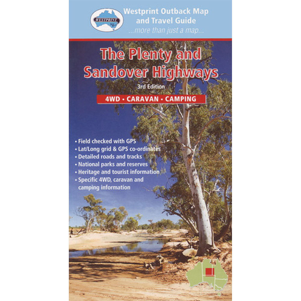
The Plenty & Sandover Highways provide the most direct access from Alice Springs to Boulia, Mt. Isa and other parts of western Queensland. Westprint Maps are "more than just maps".
John Deckert and daughter Jo Ussing combine their talents to create maps that give travellers a much broader range of information which has resulted in the continuing development of maps designed especially for 4WD, caravan and camping travellers.
All Westprint maps contain notes on history, explorers, points of interest, surrounding flora and fauna and contain various photos of landmarks. The maps are very clear to read and have road and track distances, rest areas, specific 4WD, caravan and camping information, heritage and tourist information, national parks and reserves, Lat/Long grid and GPS co-ordinates.
Product Specifications
- Unique number coding system
- Historical and Exploration
- Permit information and important phone numbers
| Length : 25 cm | Width : 12 cm |
| Height : 0.3 cm |


Easy Returns
Free 365 Day Warranty

Shop & Pay in your currency
Now shipping to 40+ countries

100,000+ Products
Amazing Brands. All Gift Occasions.
Related Products
Top Selling Items


Trending Products