
Payment & Security
Maksutietosi käsitellään turvallisesti. Emme tallenna luottokorttitietoja, emmekä ole pääsyä luottokorttitietoihisi.
Don’t Miss These Deals!


Kuvaus
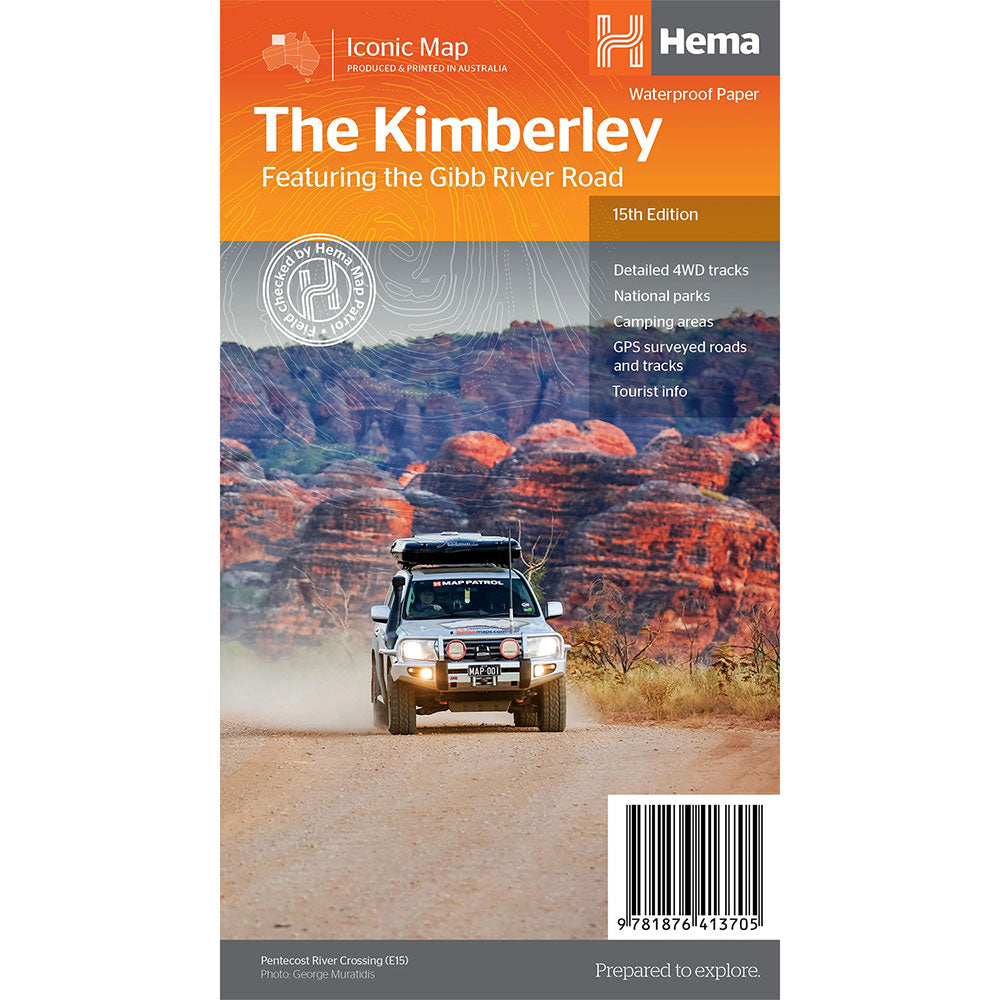
A regional map of the Kimberley that features the iconic Gibb River Road. On the reverse are inset maps for Purnululu National Park, the Dampier Peninsula and the Parry Creek area.
Detailed trip coverage and drive detail for the Gibb River Road is featured as well, with inset mapping covering the journey and corresponding text to guide explorers.
Features Hema's iconic mapping and detailed points of interest, combining Hema's entire database of remote roads and 4WD tracks with touring points of interest and topographic information.
Also included are national park information and relevant contact details for pre-trip planning and use on the road or track.
Product Specifications
- Waterproof paper
- Detailed 4WD tracks
- National parks
| Length : 25,2 cm | Width : 13,8 cm |
| Height : 0,3 cm |


Helppo paluu
Ilmainen 365 päivän takuu

Osta ja maksa valuutassasi
Toimitetaan nyt yli 40 maahan

100 000+ tuotetta
Upeat tuotemerkit. Kaikki lahjatapahtumat.
Aiheeseen liittyvät tuotteet
Top Selling Items


Trending Products