
Payment & Security
Vaše platební údaje jsou zpracovávány bezpečně. Neukládáme údaje o kreditní kartě ani nemáme přístup k informacím o vaší kreditní kartě.
Don’t Miss These Deals!


Popis
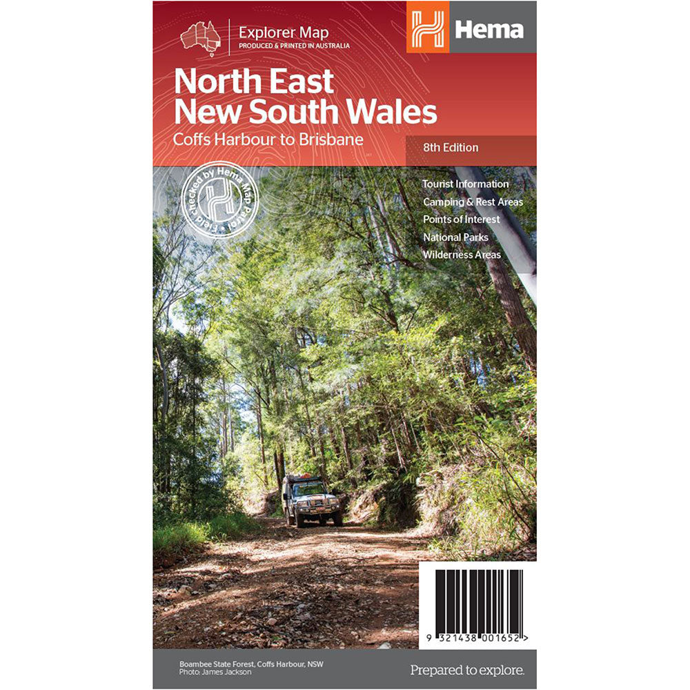
A regional map of North East New South Wales (1:375,000) that is the perfect companion for touring through North East New South Wales (NSW).
The map features information on the major touring routes through the region including the Summerland Way, Bruxner Highway, Waterfall Way and Gwydir Highway, as well as major tourist attractions along both the Pacific Highway and the New England Highway.
Also included are listed national parks within the region, contact information and events.
Top scenic drives, Camping and rest areas, Fully indexed, Events and information, Points of interest, Waterproof paper
Product Specifications
- Top scenic drives
- Camping and rest areas
- Events and information
| Length : 25 cm | Width : 14 cm |
| Height : 0,3 cm |

Dopřejte si neuvěřitelné úspory!
Produkty na prodej - Nakupujte hned!

Objevte naši nejnovější sbírku!
Nové příjezdy - Nakupujte hned!

Snadné návraty
365denní záruka zdarma

Nakupujte a plaťte ve své měně
Nyní doručování do 40+ zemí

100 000+ produktů
Úžasné značky. Všechny dárkové příležitosti.
Související produkty
Top Selling Items


Trending Products